We use cookies to ensure our site functions properly and to store limited information about your usage. You may give or withdraw consent at any time. To find out more, read our privacy policy and cookie policy.
Manage Cookies
A cookie is information stored on your computer by a website you visit. Cookies often store your settings for a website, such as your preferred language or location. This allows the site to present you with information customized to fit your needs. As per the GDPR law, companies need to get your explicit approval to collect your data. Some of these cookies are ‘strictly necessary’ to provide the basic functions of the website and can not be turned off, while others if present, have the option of being turned off. Learn more about our Privacy and Cookie policies. These can be managed also from our cookie policy page.
Strictly necessary cookies(always on):
Necessary for enabling core functionality. The website cannot function properly without these cookies. This cannot be turned off. e.g. Sign in, Language
Analytics cookies:
Analytical cookies help us to analyse user behaviour, mainly to see if the users are able to find and act on things that they are looking for. They allow us to recognise and count the number of visitors and to see how visitors move around our website when they are using it. Tools used: Google Analytics
Share New Shared Path at Station Precinct on FacebookShare New Shared Path at Station Precinct on TwitterShare New Shared Path at Station Precinct on LinkedinEmail New Shared Path at Station Precinct link
Consultation has concluded
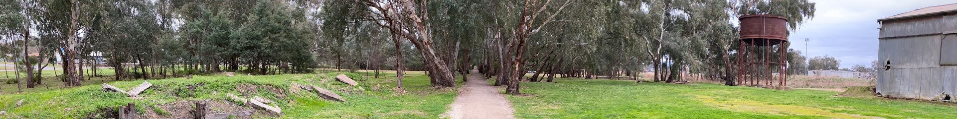
We're proposing to add a new shared path to the Great Victorian Rail Trail near Mansfield's developing Station Precinct, and seeking community feedback.
During consultation over the Station Precinct last year, community groups suggested that a widening of the Rail Trail in this area and extra separation between cyclists, pedestrians and horse riders would improve the experience and safety of users.
Unfortunately, widening is impractical due to the need to remove established trees alongside the trail. Instead, we're proposing to add a new path between Mullum Wetlands and Maroondah Highway, running parallel to the existing trail.
The proposal is a 2.5m wide compacted gravel path with creek crossings, beginning at the Visitor Information Centre and rejoining the existing trail at Withers Lane. Concept design drawings are available on this page, with the bold green and purple lines showing the proposed new path location.
The new shared path would increase the total capacity of the Rail Trail and reduce mixed traffic. Pedestrians may continue to use the existing trail, and the new path will be available for cyclists and horse riders.
To give feedback, please leave us a comment below.